Managing roads and footpaths doesn’t have to be costly, time-consuming, or complex.
At Fedasen, we’re proving that innovation can simplify and elevate infrastructure management.
Proudly Australian and grounded in deep domain expertise, our team combines advanced AI, machine learning, and geospatial intelligence to transform the way roads and roadside assets are identified, assessed, and managed.
The Fedasen Intelligent Road Analyser (FiRA) empowers councils, maintenance providers and infrastructure managers to build smarter, safer, and more sustainable networks. With models trained across more than 170,000 kilometres of roads and footpaths throughout Australia and New Zealand, Fedasen sets the benchmark for automated condition assessment, predictive planning, and evidence-based asset management.
We’re committed to exceptional client satisfaction, workplace safety, and the responsible protection of information assets. As we continue to explore new frontiers in AI and infrastructure technology, Fedasen remains focused on driving progress for cities and communities everywhere.
Follow us on LinkedIn for upcoming updates or book a demo session.
FiRA – Fedasen Intelligent Road Analyser
We deliver the next generation of fully automated geospatial asset data collection, condition assessment and asset management systems using Machine Learning and Agentic AI, enabling data-augmented Smart Cities with precision, automation, and insight.
Fedasen in the Spotlight
Fedasen Live Demo
AI-Driven Road Asset Management
Active Assessment of Footpath and Bikeway Networks
KAIS Wins IPWEA-QNT Excellence Award for Asset Management
and more >>>
Innovative Scalable AI-Powered Solutions
Fedasen is an Australian technology company leading the transformation of road and roadside asset management through AI, machine learning, and geospatial innovation.
Fedasen has developed intelligent, automated solutions that redefine how infrastructure assets are identified, assessed, and maintained. Powered by its flagship technologies, FiRA for AI-driven data collection and FAMS for enterprise asset management, Fedasen delivers a fully integrated System + Data model. This approach enables real-time asset classification, condition assessment, and predictive planning, helping councils and infrastructure managers make smarter, data-informed decisions across entire networks.
Automated Asset Identification
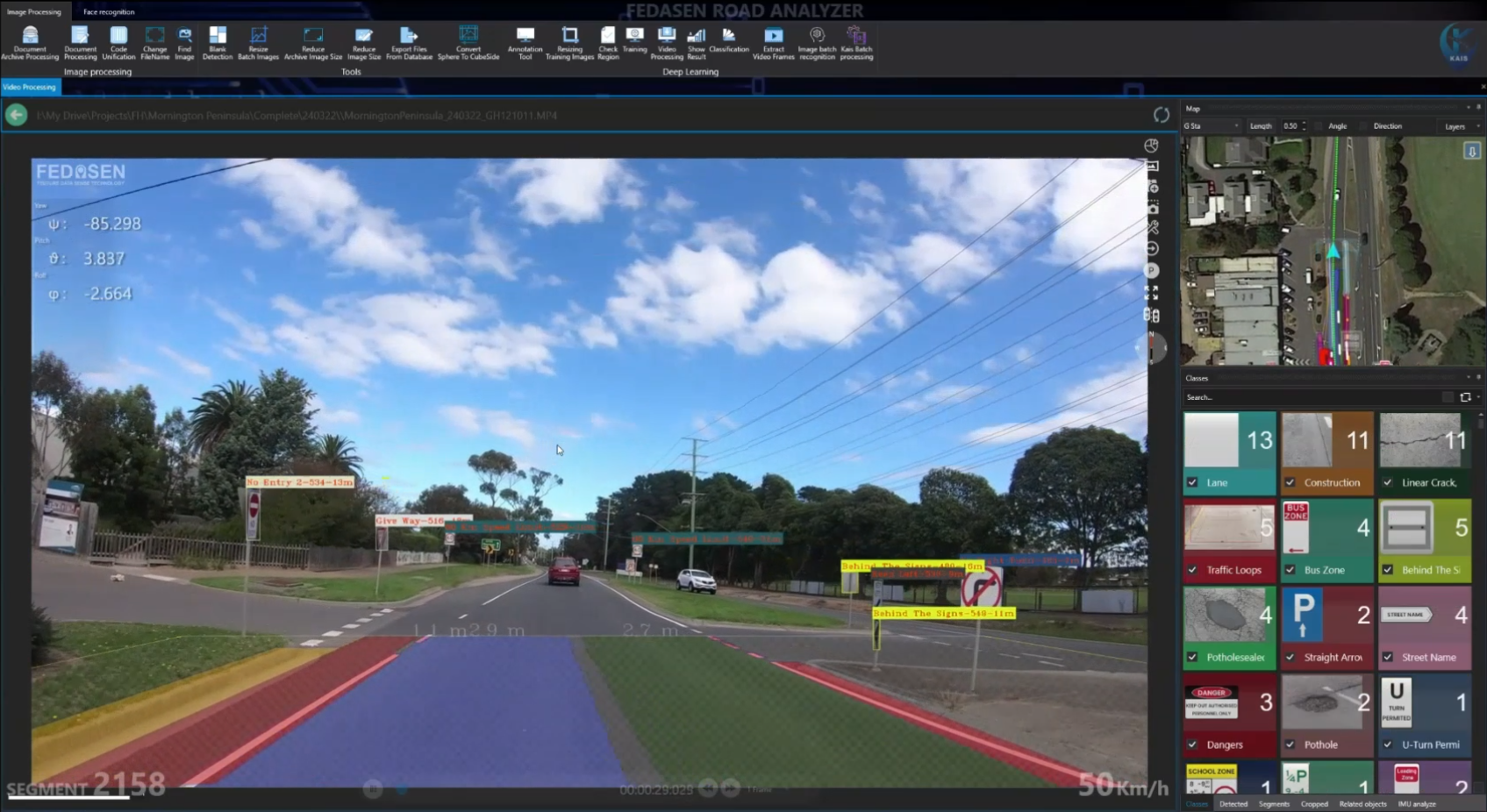
FiRA (Fedasen Intelligent Road Analyser) scans and processes the carriageway and roadsides for any type asset and defect on or by the road. It detects a wide range of elements, including road signs, traffic management signs, special-purpose zone signs, traffic control systems, barriers, kerbs and channels, city furniture, traffic monitoring systems, and natural landscaping, categorising them under multiple levels.
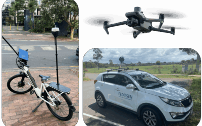
FiRA Onboard set can be mounted on any ordinary vehicle to blend in with the regular flow of traffic without requiring any traffic management. The solution can be utilised for state highways and roads, main and local roads, city streets and lanes.

Road & Roadside Asset Identification
Thanks to Machine Learning, FEDASEN’s solutions utilise a high-performance post-processing mechanism to extract and classify geo-referenced data of various types of surface, point and linear assets and build a multi-level classification, related inventory.

Signage
Road & Traffic Signs
Traffic Management
Traffic Control Systems
Speed & Incident Management System

Lines
Parking bay
Special Purpose Zone
Separator Line
Edge Line
Directional Arrow

Surface
Carriageway & Road Lanes
Footpath & Shared Path
Earth & Planted Verge
Hump & Driveway
Bridge & Overpass

Zone
School Zone
No Stopping & Parking Zone
Bus & Taxi Zone
Loading Zone
Special Vehicle Zone
Structure
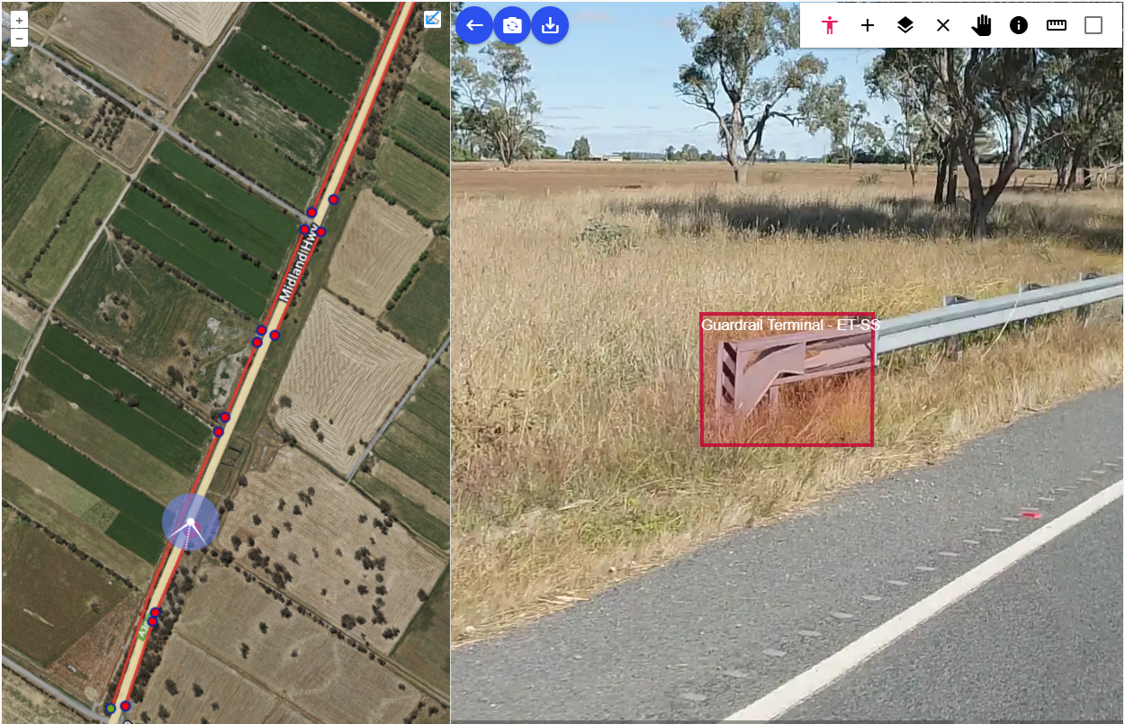
Safety Barriers & Fencing
Retaining Wall
Kerb & Channel & Drainage
Bus Stop & TGSI
Manhole and equipment

Landscape
Grass-covered Areas
Exotic Species
Flowering Plant
Tree
Shrub & Hedges

Pavement Marking
FEDASEN provides a specific solution for pavements and pavement markings. The solution sweeps the surface of the carriageways, hunting any longitudinal, traversal, area and point markings by which the loading zones, school zones, bus bays, parking spots, lane separators and driving restrictions are demarcated.
The ability to scan multiple lanes of a wide carriageway – such as a highway – in one trip is an extraordinary feature of our solution that makes it much faster and more affordable in comparison.
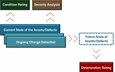
Pavement Condition Assessment is an integral part of all our solutions, which is performed using pattern recognition and Machine Learning. The solution also notices the changes in the placement and serviceability condition of the assets and keeps a change history for audit and planning purposes.
Asset Condition Assessment
FiRA employs advanced AI-based image processing techniques to assess the condition of both point and linear assets across road and footpath networks. For point assets, FiRA generates a direct condition rating ranging from Very Good to Unserviceable. For linear assets, such as line markings, safety barriers, and road stretches, FiRA provides two distinct condition ratings:
- Defect-Based Condition Assessment, which evaluates the type, severity, and distribution of defects within a segment.
- Overall Segment Condition Evaluation, which aggregates all defect data to produce a comprehensive condition score for the entire segment.
Fedasen’s Smart Services
Pavement Defect Identification
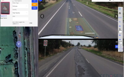
Our solutions, aside from the overall condition rating which is performed on any type of asset, detect and classify assorted types of pavement defect and deformation. They also determine the level of severity of the defects and figure out if they impose any significant safety hazard to the public.
Cracking
Longitudinal Cracking
Longitudinal Joint Cracking
Transverse Cracking
Crocodile Cracking
Corner Cracking

Pothole & Patching
Pothole
Pothole Patch
Unsuccessful Patch
Heavy Patch

Joints
Edge Drop
Concrete Joint damage
Misalignment
Disjointing
Slab Replacement
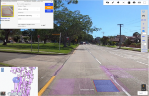
Texture
Depression
Stripping & Scraping
Spray seal
Flushing & Bleeding & Raveling
Spalling & Micro Milling
Footpath & Verge
Our customised solution for capturing and processing numerous classes of assets and defects covers footpaths, shared paths, cycle paths, verges, driveways and ramps, bus stops and shelters, stairs, infrastructural equipment, service pits and many more.
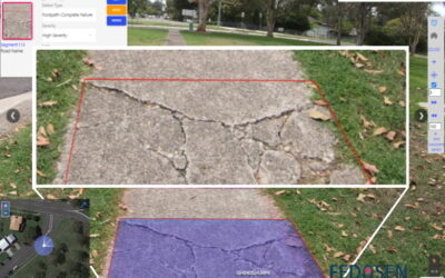
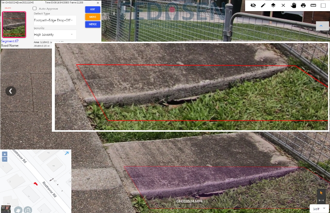
The pathway hazards – such as edge drop-off, tree root and overhanging – are discovered and their severity is determined.
Furthermore, the safety risks are automatically assessed by the system without any on-site inspection, referring to engineering handbooks and manual data entry.

Footpath & Shared Path Defects
Planing
Our solutions contain components for automated usage/traffic pattern identification, hazard identification, safety risk rating, high-level priority ranking for the tasks, cost prediction for maintenance tasks, automated work order and task scheduling. Such components enable the automated creation of various plans including short term plans, long term plans, and financial plans. By using Fedasen’s components for high-level priority ranking and work order generation, we can automatically propose response time for maintenance work considering a comprehensive set of factors including condition rate, severity, deterioration rate, safety risks, the volume of asset/traffic users, available budget, estimated current cost, and estimated future cost within short- and long-term maintenance plans.
Short Term Planning
High-level priority ranking
Automated short term work order and recommendations
Automated work order and scheduling for maintenance tasks
Automated hazard identification
Rapid and efficient responding to hazardous situations
Long Term Planning
Optimal, cost-aware, and efficiency-aware long term planning
Automated long-term maintenance recommendations
Automated insights on efficiency and impacts of changes on different planning options
Deep data-driven planning insights
Financial Planning
Budget and financial planning for short and long term
Current and future cost prediction for maintenance work
Customers
Key Advavtages
Every solution we provide is:
- It utilises computer vision to automatically detect objects on or at the side of the roads
- It employs machine learning to train and enhance itself
- It uses multiple sources – image, videos, data forms – to improve the quality of data
- It accepts and processes the output high-resolution recording devises
- It is fed by the devices that detect the physical location of the objects with a centimetre-level precision
- It improves the accuracy of the data in each recording round trip
- It works on any type of standard device, from desktop PCs to mobile devices
- It accepts the base images and videos from various recording devices
- Its data can be accessed through various interfaces, from its own user interface to service buses
- It accepts input from a wide range of recording devices, not just the high-end ones, depending on the precision required and the devices owned by the customer.
- It can be implemented in a purely SaaS environment or be set up on the premise of the customer.
- It is developed according to the best practices of software development
- It conforms to the highest standards of web application development in security, performance, scalability
- It integrates with existing modern and legacy systems
ISO Certificates


